

Home / Location
The point where Honduras connects with the world.
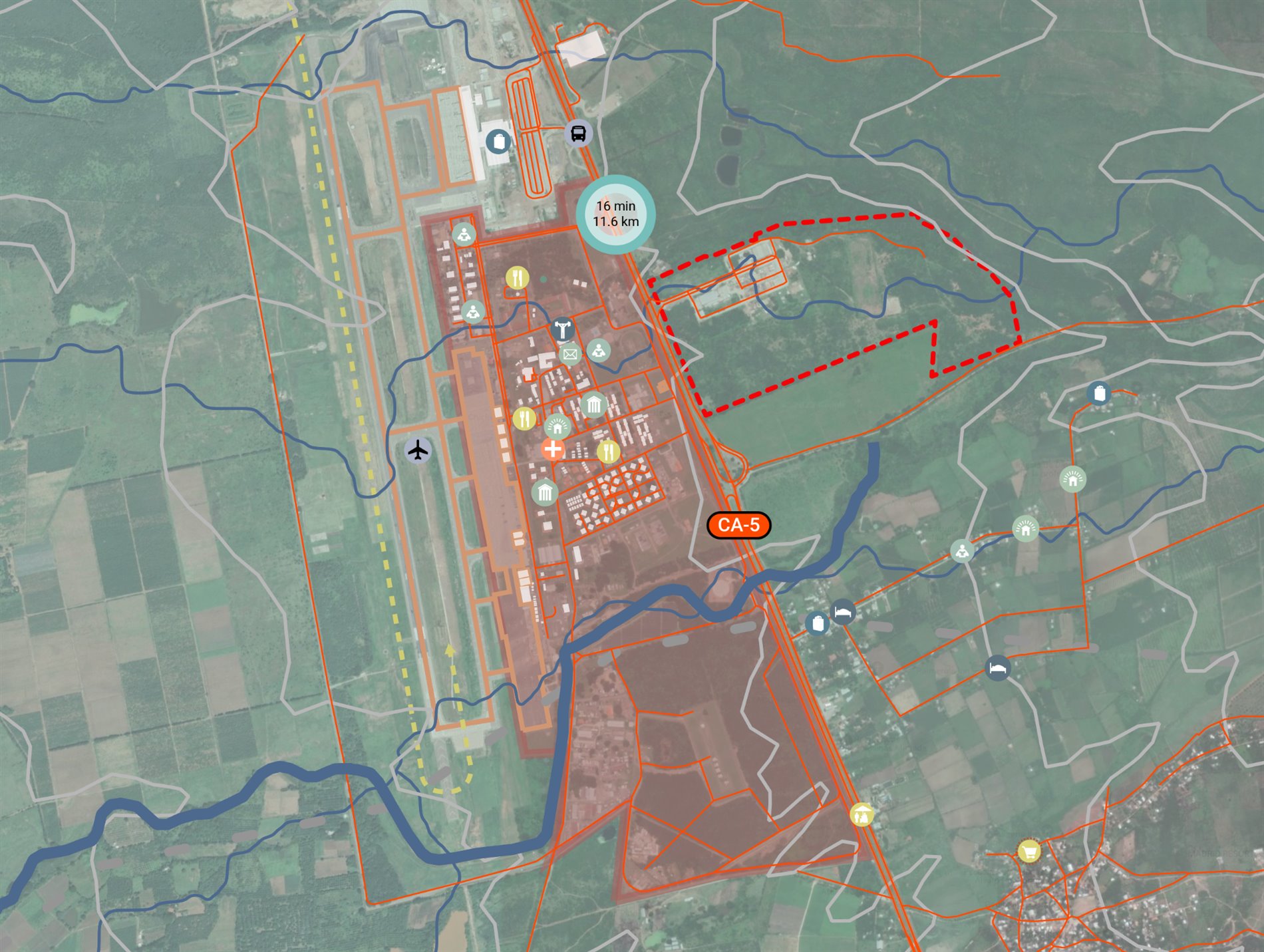
Facing Palmerola International Airport, on the CA-5 corridor and at the geographic center of the Americas.
Connectivity
By air, land and sea.
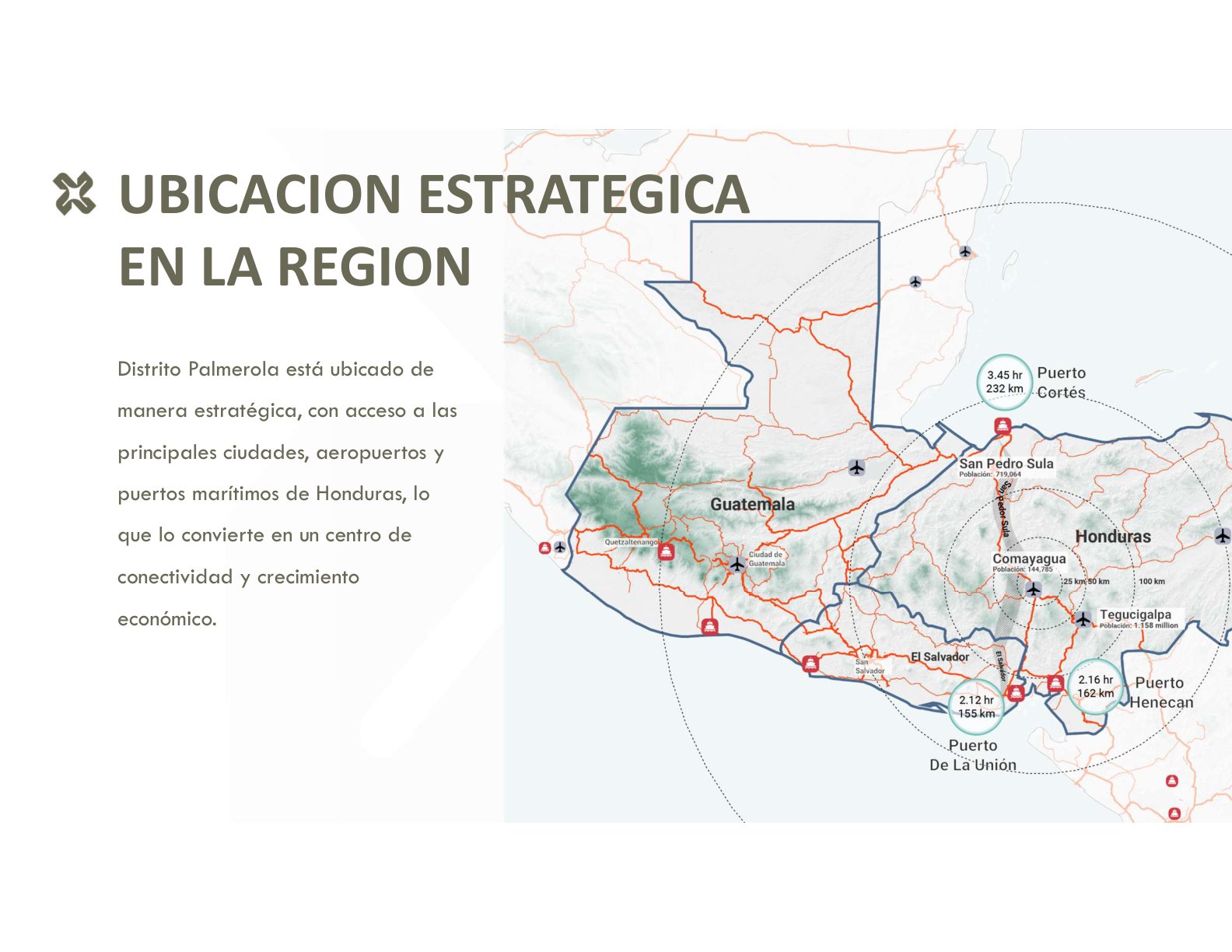
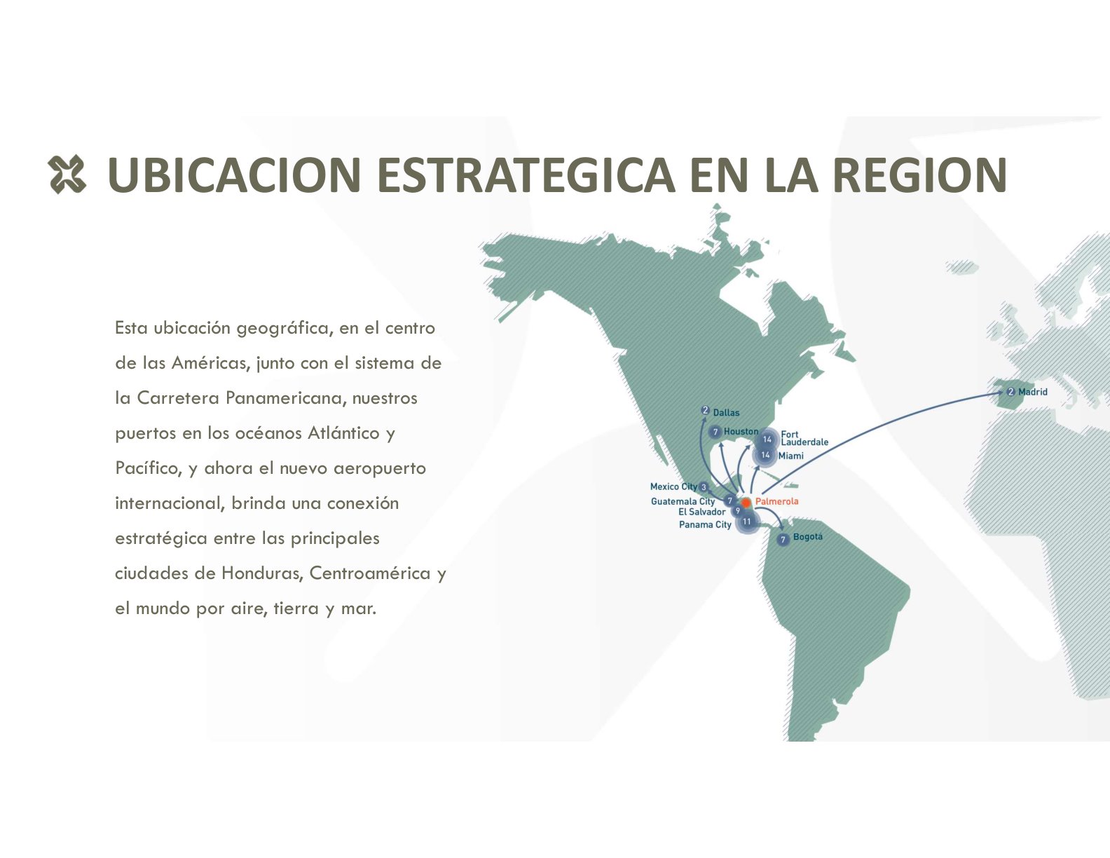
This location —at the center of the Americas, along the Pan-American Highway, with ports on both oceans and now the new international airport— provides a strategic connection to Honduras, Central America and the world.
Air
Facing Palmerola International Airport (XPL), the country's new gateway to the skies.
Land
Along the CA-5 corridor, the logistics artery linking Honduras's major cities.
Sea
Access to Atlantic and Pacific ocean ports through the national network.
The site within the region
Minutes from everything that matters.
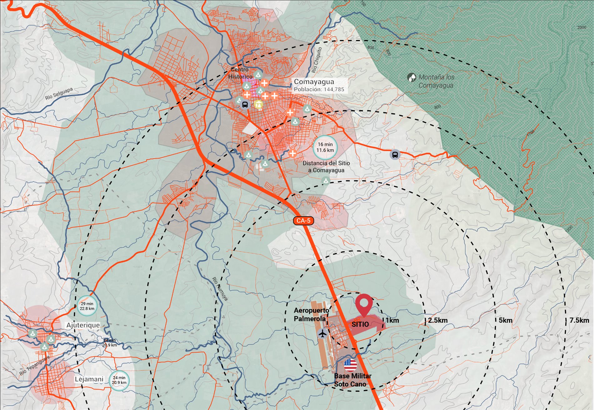
- Facing Palmerola International Airport (XPL) — less than 1 km from the site.
- 16 minutes (11.6 km) from the historic center of Comayagua.
- Along the CA-5 corridor, the Pan-American Highway in Honduras.
- Beside Soto Cano Air Base and the Comayagua valley.
Context
Comayagua, the heart of Honduras.
The site sits 11 km (~16 min by car) from Comayagua: a mid-sized, colonial and historic city with everything it needs to become a tourism and residential hub for the country. Its historic center boasts public spaces worthy of global cities.
~145,000 residents
A mid-sized city, growing fast and fully serviced.
11 km · ~16 min
From the site to Comayagua's historic center, along the CA-5 corridor.
Tourism hub
Colonial heritage, culture and the new international airport as a driver of visitors.
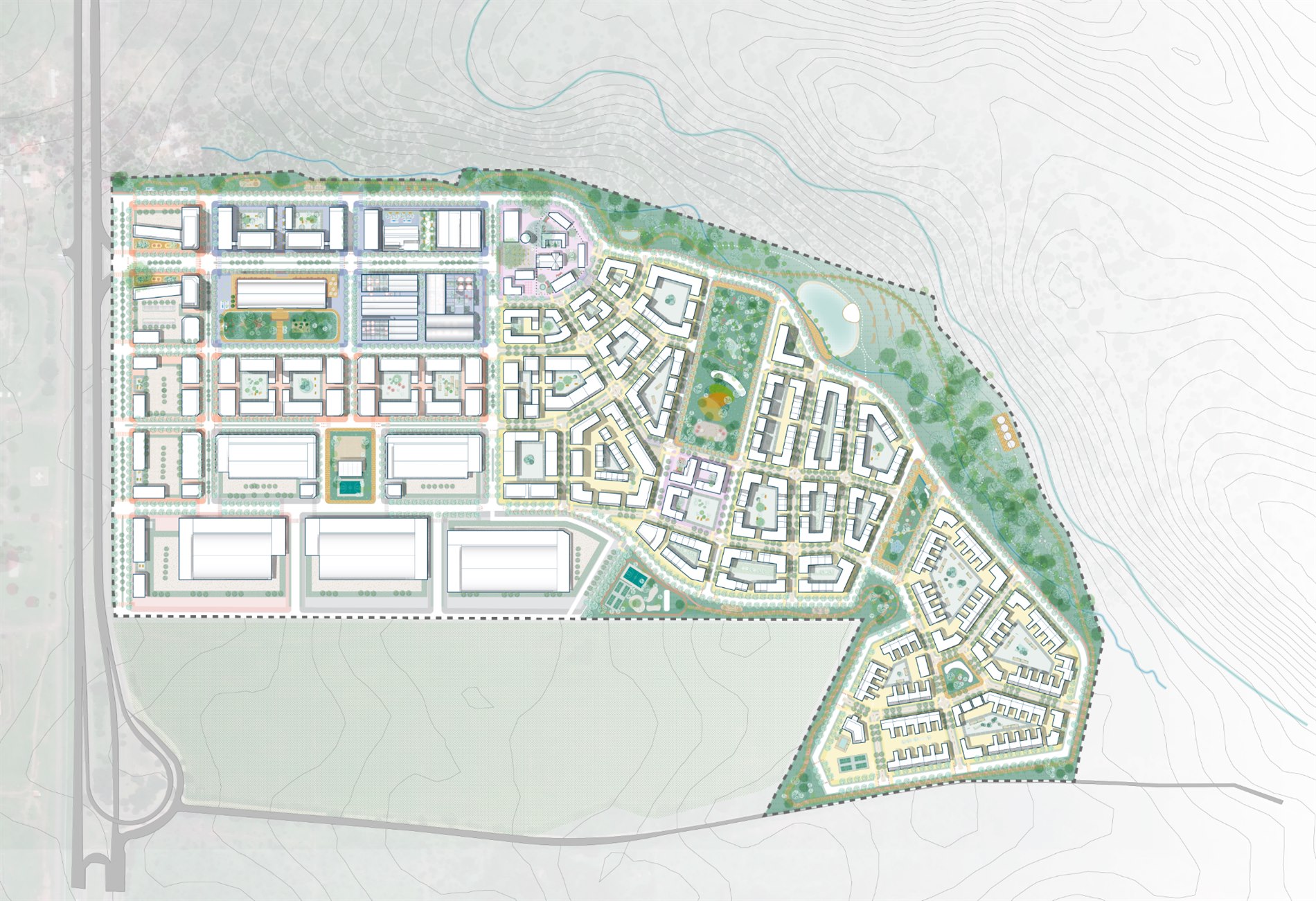
67 hectares
Land with a vision for the future.
The 67 hectares of Distrito Palmerola unfold along the CA-5 corridor, harnessing the topography and direct airport connection to create a mixed-use district unlike any other in the region.